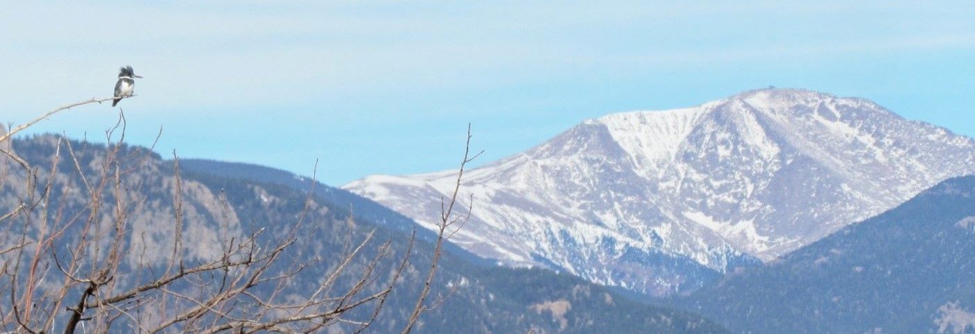

The so-called “Front Range” of the Rocky Mountains (the name only makes sense when approaching from the east, as it is the “Back Range” when coming from the west) rises to nearly 10,000 feet (3000 meters) from the western edge of the Great Plains at 6,000 feet (1830 meters), where Colorado Springs sprawls across the land. The stretch of Front Range along the city’s northwestern fringe is named Rampart Range, and one of its mountains is Blodgett Peak (the triangular peak seen in the center of the featured photo above).
Blodgett Peak towers over the western edge of Blodgett Peak Open Space. Created in 2001 thanks to TOSC (Trails and Open Space Coalition), which saved it from development, the area has since been enlarged twice and now comprises 384 acres. It is named for the Blodgett family, onetime owners of the land from which the home of the nearby United States Air Force Academy was also carved. The open space is surrounded in three direction by the Pike National Forest, and on the east is bordered by the exclusive Peregrine neighborhood.
Blodgett Peak at 9,423 feet (2872 meters) isn’t the tallest mount of the Rampart Range, but represents one of its most popular hiking destinations, likely because of its proximity to town and the short distance between trailhead and summit, which measures only 1.75 to 2 miles (2.9-3.2 km), depending on the route. We are spoiled with hiking trails in and near Colorado Springs, and by virtue of living at the south end of town, have not explored too many trails on the north end. Even though I put Blodgett Peak on my hiking wish list long ago, the trail to the top, which has always been steep, poorly marked, and characterized by loose gravel, became even more challenging in the wake of the devastating 2012 Waldo Canyon Fire, and I did not feel comfortable to try it without a trusted guide.
When my friend Andy, who lives at the north end of town and is familiar with its terrain, offered to take me along on his yearly August ascent of Blodgett Peak, I jumped at the chance. While two miles (3.2 km) and an elevation gain of about 2,300 feet (700 meters) sound completely feasible, I can attest in retrospect that the peak truly kicks butt! I used to be fitter not too many years ago, but my mostly gentle to moderate bird walks nowadays barely count as aerobic exercise. The relatively flat lower trails quickly gave way to steep segments topped with gravel or boulders, and I often used my hands to push or pull myself up. Predictably, there was a lot of puffing and perspiring on the way up.

Start of the main trail directly west of the trailhead

View of Colorado Springs and the plains on the eastern horizon from along the trail

Closer view of Blodgett Peak

Broad-tailed Hummingbird along the trail
An uplifting bonus during the climb were avian encounters with hummingbirds, Red Crossbills, and Western Tanagers, to name a few, and a pair of Rock Wrens greeted us with a sweet tune at the summit. Wildflowers helped brighten the experience, as did the many insects who frequented them. We were also fortunate to have a cloud cover for most of the ascent, as it kept the temperature from exceeding 80⁰ F/27⁰C (which, at this altitude, feels much warmer). Once we reached the top, the sun felt pleasant on our tired muscles; and a slight breeze refreshing.
One of the main reasons to summit any mountain is surely to enjoy the vistas, and Blodgett Peak did not disappoint. Pikes Peak has a commanding presence in this region and I was astonished for how long the 14,115 foot (4300 meters) behemoth remained hidden from sight—until we were nearly on top of Blodgett Peak. I never tire of the many different faces of this landmark which the Utes, on whose ancestral lands it is located, call Tava-Kaavi (pronounced tah-va-kaav), which means “Sun Mountain.” No less captivating is the contrast between the Rockies on one horizon, and the Great Plains on the opposite. A bird’s eye view of one’s surroundings creates a different, deeper kind of appreciation for the lay of the land and the day and panorama were so pleasant that we lounged on the pinnacle for an-hour-and-a-half, absorbing all those impressions. To our surprise, only one fellow hiker summited during that interval and stayed for mere minutes.

Southwesterly view from the Summit of Blodgett Peak, with Pikes Peak dominating most of the skyline (evidence of previous forest fires in the foreground)

Northwesterly view from the summit of Blodgett Peak: Rampart Reservoir

Northeasterly view from the summit of Blodgett Peak: Air Force Academy

Southeasterly view from the summit of Blodgett Peak: Pikes Peak on the right side of the photo and Cheyenne Mountain on the left

Rock Wren at the summit

Unknown (to-me) butterfly at the summit
Well, we all know that the truism “what goes up, must come down” is true. And if you have hiked before, you will probably agree that coming down is more difficult than going up. Breaking and balancing against gravity and loose gravel puts a lot of stress on ankles, knees, and hips, and quadriceps and calf muscles in particular have to work overtime. And so it was with no small degree of effort that we gingerly maneuvered down the steep and slick segments of non-trail until we touched lower ground, where the going was less taxing.
Thank you, Andy, for dragging me along on this hike and enabling me to fulfill a long-held wish, even if I was groaning with each step for the next couple of days. And thank you for keeping me fueled with enlivening and energizing peanut M&Ms. Let’s do it again next August. By then my legs should have recovered. 😊

I envy you, what gorgeous views including the birds! And when you arrive safely back down hopefully the effort was worth it?
Greetings from Frankfurt/Germany Ira
LikeLiked by 1 person
Thank you, Ira. It was definitely worth the effort. I loved every minute of it!
LikeLike
Fabulous views (and birds, too) so all the hard effort getting to the top was clearly worth it. Time for a long, hot, relaxing soak in a bath-tub, I think.
LikeLiked by 1 person
Thank you, Mr. P. Despite my whining, I had a wonderful time. In theory, that soak sounds good, but hot water and hot summer air in combination are a little overwhelming. My shower felt very restorative, though. 🙂
LikeLiked by 1 person
That’s an interesting transformation of Blodgett Peak to Butt Kick Peak. At the outset I thought that was really the mountain’s name and I was prepared to comment on how pithy and down-to-earth it is. As far as I can tell, no mountain bears the actual name Butt Kick, but(t) Austin has a café named Kick Butt Coffee that buttresses its clients against the unwanted effects of caffeine deprivation.
LikeLiked by 1 person
Thank you, Steve. I think it would be an apt name for this (and other butt-kicking) peaks. And it is a good name for a café.
LikeLike
Wow, that is a steep hike! But a worthwhile endeavor, based on the views from the summit.
LikeLiked by 1 person
Thank you, Diana. I actually thought of you when I prepared this post. You would enjoy this hike!
LikeLiked by 1 person
This hike gave you a month’s worth of aerobic exercise. Maybe two months’ worth!
LikeLiked by 1 person
Does that mean that I can be lazy for one to two months? 😊
LikeLiked by 1 person
👍
LikeLiked by 1 person
Tanja, great job on highlighting and documenting some of the reasons we want to move to CO for retirement. I agree, no matter how many times you see the “Front” (or back) Range it never gets old. The light is always changing the narrative. The contrast between the plains and the mountains is a bit overwhelming when you consider what it took to create such a sharp definition between them. Keep these stories coming please.
LikeLiked by 1 person
Thank you for your kind comment, Brad. We are lucky to be living here, and having such spectacular scenery. I never grow tired of looking at the front (or back) side of any mountain and since I started birding, I have also come to appreciate the abundance the prairie holds on offer.
LikeLiked by 1 person
I hope you are putting your finds on eBird so we can see the Hotspot info during our next visit to see our daughter in CO.
LikeLiked by 1 person
It’s there. 🙂
LikeLiked by 1 person
Whew! What a hike, Tanja. I almost felt like I was there. My butt won’t reap any of the benefits, but it sure was an exhilarating read. 😊
LikeLiked by 1 person
Thank you, Julie, I’m glad you enjoyed the hike vicariously. I think we should be able to get some physical benefit from reading about other people’s work-outs. 😊
LikeLiked by 1 person
Well put and yes we should!
LikeLiked by 1 person
Found this on-line https://coloradofrontrangebutterflies.com/butterfly-families but can’t find your butterfly in it! It looks like a Fritillary maybe an aberrant.
Nice post Tanja.
LikeLiked by 1 person
Thank you, Brian. I have visited that website and found some species, but like you, didn’t have any luck with the one in the photo. I also have a printed butterfly guide and often flip through the photos, but this one didn’t seem to be represented either. I really liked its earth-tone, muted colors.
LikeLike
Thanks for the tour; it was much easier for us to enjoy the trail. 🙂
I liked your first sentence about the ‘Front Range’–I’ve always wondered about that; I mean, it can’t be the ‘Front Range’ all the way around, right?
Your photos are lovely, the two bird captures just stunning.
LikeLiked by 1 person
Thank you, Tina, I’m glad you enjoyed the trail vicariously. I was so pleased with all the bird sightings that day and only wish I had taken more photos. Because the trail was so steep, I didn’t pull my camera out of its bag often enough, so I missed out on some real beauties, including a Williamson’s Sapsucker, which I don’t see very often near town.
LikeLike
Well done, Tanja, great post covering your hike. I know with my knees I’d never make it, but I enjoyed it vicariously.
LikeLiked by 1 person
Thank you, Eliza, I’m glad you enjoyed the hike. Sorry to hear about your knees. So far, mine are ok, even if my hand and foot joints are giving me trouble. I think it sucks that our parts wear out before we do.
LikeLiked by 1 person
Truly… I suppose there are now joint replacements, but they are never the same as the original. I’m putting that off as long as I can.
LikeLiked by 2 people
I would, too. There are no guarantees, and some people have horrible surgical complications.
LikeLiked by 2 people
Can I crash this weary joints discussion? 🙂 Oh,my arthritic hands! I’m working hard at my harp to keep the joints a-moving.👍
LikeLiked by 1 person
Sorry you are also suffering from arthritis, Julie. I hope you will never have to quit playing your harp.
LikeLiked by 1 person
So far so good with my harp.In addition, they say learning a new musical instrument is good for the brain cells.♥️🤔
LikeLiked by 1 person
Yes, they do. May your fingers and brain cells keep benefitting from your beautiful instrument and playing.
LikeLiked by 1 person
That was quite a climb, Tanja. You had me breathless. Such impressive scenery too. And the birds!
LikeLiked by 1 person
Thank you, Michael. I was breathless, too, even though I live at this elevation. Coming from Lancashire, it would be helpful to acclimate for a while. The birds, on the other hand, had no trouble, neither with the altitude nor with the steep hills. 😊
LikeLiked by 1 person
Yes, my bit of Lancashire isn’t much above sea level, so I’d need plenty of time to acclimate, but I’m sure I’d have plenty to photograph in the mean time. 🙂
LikeLiked by 1 person
Right, you would not run out of motifs. 😊
LikeLiked by 1 person
Wo sich diese kleinen Kolibris doch überall herumtreiben. Wunderschön und sie sind kleine Wunder.
LG Maren
LikeLiked by 1 person
Danke, liebe Maren. Du hast recht, die Kolibris sind wirklich überall unterwegs. Und die Männchen der im Photo gezeigten Art (Breitschwanzkolibri) trillern beim Fliegen mit ihren Flügeln, so daß sie leicht zu hören und deshalb zu finden sind.
Ich wünsche Dir ein gutes Wochenende.
Lieben Gruß,
Tanja
LikeLike
Impressive scenery! You are very lucky to have walking trails like this around you. 🙂
LikeLiked by 1 person
Thank you, Ann. I do feel lucky each day when I look at our beautiful scenery, or whenever I take a hike. 🙂
LikeLiked by 1 person
Danke für die interessanten Bilder und den trefflichen Text zu dieser herrlichen Wanderung, liebe Tanja.
LikeLiked by 1 person
Danke, lieber Ernst. Es freut mich, daß Du mitgewandert bist.
Liebe Grüße,
Tanja
LikeLiked by 1 person
Tanja – I love this post! First of all, your beautiful photos. Second, I felt like reading this post, I got to go on a hike with you. Even though we live far away, it felt like I got to share this moment with you and that was wonderful. Thank you so much for taking me virtually hiking with you! -Jill
LikeLiked by 1 person
Thank you, Jill. Thank you for joining me on this hike. I hope you aren’t too sore as a result. 😊
LikeLiked by 1 person
You’ve done me a great favor, Tanya. Not only was the account of your hike interesting and enjoyable, it was a good reminder that this flatlander needs to do something about getting in shape before the weather makes trips to our ‘mountainous’ hill country possible again. Between the heat that’s often kept me indoors, and my tendency to stroll, meander, and lollygag when I’m out with my camera, I’m out of hiking shape. I have terrific flexibility and strength because of my work, but I need to focus on cardio before I’m ready for Enchanted Rock!
LikeLiked by 1 person
I know how you feel, Linda. Walking slowly and stopping every few yards to look at a flower, or insect, or bird is not really conducive to getting in shape, but it’s still better than sitting and probably gives us some physical benefits, in addition to the mental and emotional enjoyment.
I hope your time in hill country will be truly enchanting once you make it there.
LikeLiked by 1 person
I always enjoy your mountain scenery treks, Tanja. I can barely wrap my head around the 14000 feet height. Around here, going to the mountain involves a trip one town over to Mt. Wachusett, elevation 2005 ft. 🙂 How much harder is it to breathe at your hike’s elevation? You must be in quite good shape in spite of your comments!
Wishing you a good Labor Day, and many fall hikes in the coming weeks.
Best,
Julie
LikeLiked by 1 person
Thank you, Julie. Even living in CO, where we have more then fifty 14rs, I’m always impressed when I see our local 14er, Pikes Peak. I have been to its top a few times on foot, but not for many years. The altitude is definitely noticeable, especially for visitors from lower elevations. People can and do get altitude sickness, which is no fun.
I look forward to fall hikes when the temperature will be more pleasant. I hope you will also get out and enjoy New England’s fabled autumn.
Best,
Tanja
LikeLiked by 1 person
What lovely shots of landscape and wild life. It is so rare to see a Humming Bird still.
LikeLiked by 1 person
Thank you, Kerry, it was a great experience. Luckily, even busy hummers have to take a break every once in a while.
LikeLiked by 1 person
the hummingbird is so gorgeous, and also your photo of the butterfly, and of course overall beautiful scenery!
LikeLiked by 1 person
Thank you, Karin. I wouldn’t attempt to climb such a peak if it weren’t for the beauty of and all around it.
LikeLike
Wonderful. I can’t tell you the number of times I’ve had to explain to people that coming down an incline (in my case usually running down) is a LOT harder on your body as one would think. You keep making me drool with those birds – in this case the Wren and the Hummer, both of which I’m still missing this year. Thanks for taking us along with you.
LikeLike